Mount Scott Trail
Crater Lake National Park

Distance: 4.3 miles (6.9 km)
Cumulative Elevation Gain/Loss: 1318 feet (402 m)
Date Visited: Saturday, July 29, 2017
Mount Scott Trail Map (KTNP)
So far in Crater Lake National Park, we had hiked some lesser known trails like Boundary Springs. It was finally time to do some more “popular” hikes. Today we decided to hike Mount Scott, a 4.3 mile out and back trail located on the eastern side of the park. The trail ascends 1318 feet, and features views of Crater Lake and the surrounding mountains. Mount Scott is the highest point in Crater Lake National Park at 8929 feet and is named after Levi Scott (1797–1890), an Oregon politician and pioneer.
After getting a late start, around 11 a.m., we peered over steep cliffs on the side of Rim Road as our car weaved its way up to the trailhead. The parking lot was full – it’s small given Mt. Scott’s popularity. Thankfully, a short distance beyond was a picnic area that had some parking. It also had a pit toilet, which the lot at the trailhead lacks.


Mt. Scott Trail
Carefully, we walked along the narrow shoulder of the road to the trailhead. Even in late July, a small snowfield partially covered the beginning of the trail and other areas of the mountain. Some hikers went around, and some trudged through.
Initially, the trail ascended gently, but quickly became steeper and more exposed to the sun. On a warm summer day, we were glad to have the occasional tree to take a break under, as well as a slight breeze. We ascended up switchbacks, which allowed for beautiful views of the surrounding mountains. While we stopped to admire the mountain view, we realized Crater Lake was already visible!


As usual, I stopped to check out some wildflowers. An older couple passed us and the man asked, “Oh, are you a wildflower guy too?” That made us smile (I am). We chatted briefly and he told us about a type of flower higher up that looked like something from Dr. Seuss. The fluffy flower was a called a Western Pasqueflower and we soon found it.
Not surprisingly, the views improved as we ascended, though they were partially obstructed by trees in places. The trail is steep and narrow. There were a lot of other hikers on the trail; if you’re looking for solitude, this isn’t the hike for you. We also had some unexpected guests: butterflies. Hundreds, maybe thousands of them!
As we hiked, we could hear wings flapping, and butterflies continually ran (flew?) into us, which was somewhat disconcerting. It was certainly a surprise! Ascending higher only made more appear. Why were there so many? We didn’t find out the answer until later; they were California tortoiseshell butterflies, and they appear every 5-6 years, possibly because of a migration event. Lucky us, we just happened to time it right.


Mountain Ridge and Fire Tower
Hiking further up, we passed three firefighters descending the mountain. With several active wildfires in the park, we weren’t too surprised to see them. There’s a fire tower at the peak, though there is no public access.
Switchbacks are annoying, but the turns allowed us to take in the views. Finally, we came to a ridge, which leads to the fire tower. As we walked along the narrow gravelly ridge, we enjoyed a breeze, as well as more breathtaking views of Crater Lake to the left and mountains to the right.
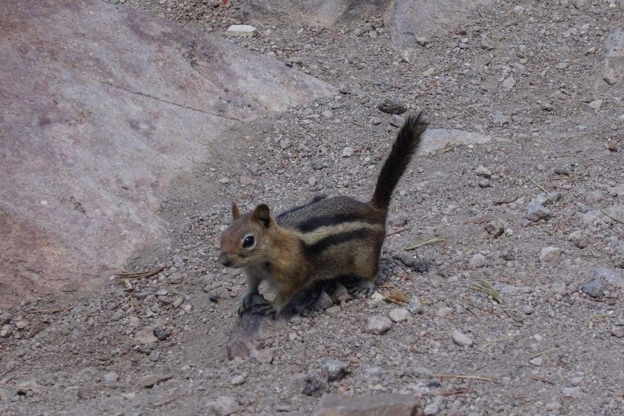
Butterflies swarmed over the ridge. We stopped to take in the phenomenon. They were flying over our heads, but they didn’t bother or land on us. It was time for lunch, so we ate near the fire tower. A ground squirrel appeared and ran around us. It had probably been fed by other tourists, so we made sure to protect our food.


After lunch, we began the steep and rocky descent. Trekking poles helped minimize the impact to our knees, and we definitely recommend them. We saw a couple pushing a stroller – probably not recommended with the rock and loose gravel, especially near the top. Although it was very warm, hikers continued to ascend in the mid-afternoon.
Mount Scott Trail has a steady incline, loose dirt and gravel, and plenty of sun exposure. The trailhead sign states that it’s strenuous, though a seasoned hiker might find it moderate. We enjoyed the trail and views, and the butterflies made it an almost otherworldly experience. Our recommendations: visit on a weekday, arrive early to avoid crowds as much as possible, and choose a day with milder weather since there isn’t much shade. Enjoy!


Mount Scott Trail
Dates: Saturday, July 29, 2017
Type: Out and back hike
Total Distance: 4.3 miles (6.9 km) round-trip
Cumulative Elevation Gain/Loss: 1,318 feet (402 m)
Time: 3 hours, including lunch and lots of photo breaks
Trail Markings: None
Difficulty: Moderate
Crowds: Very populated
Water: None; views of Crater Lake
Highlights: Views, fire tower, snow, wildflowers, butterflies
Note: If main parking lot is full, look for the picnic area further north
Directions to Trailhead: Google Maps Directions
Trail Directions
- Mile 0.0 – From the trailhead, follow the trail. You might cross a couple snowfields before starting the ascent up switchbacks.
- 2.2 – Arrive at the top of the mountain. Check out the sweeping views and fire tower, then head back down the way you came.
- 4.3 – Back at the parking lot.
Places
- Mount Scott Trailhead | 42.9316667, -122.0323522
